
Building and Dam Construction
There is a considerable amount of new building construction and damn building occurring in the MENA region as the population grows and necessary development occurs.
Building Construction: Housing developments, industrial installations, mining complexes and commercial properties all have a major impact on cultural heritage. We provide examples from Khirbet es-Suq in Jordan (Figures 1–3), El-Shaikh Ebada, Egypt (Slideshow 1), and Tell Beydar (or Beidar), Syria (Figure 4, Slideshow 2).
Two 2007 aerial photographs show the temple (APAAME_20070419_FFR-0267 Kh. uq Temple) and mausoleum (APAAME_20070419_RHB-0201 Kh. es-Suq, Mausoleum1) of Khirbet es-Suq in Jordan (Figures 1–2). They are completely surrounded, and slightly encroached on, by the outskirts of Amman. They can be seen together here on a DigitalGlobe image from Google Earth, dated to July 2010 (Figure 3).

Figure 1: Temple of Khirbet es-Suq, Jordan

Figure 2: Mausoleum of Khirbet es-Suq, Jordan

Figure 3: DigitalGlobe image of Khirbet es-Suq, Jordan, 2010
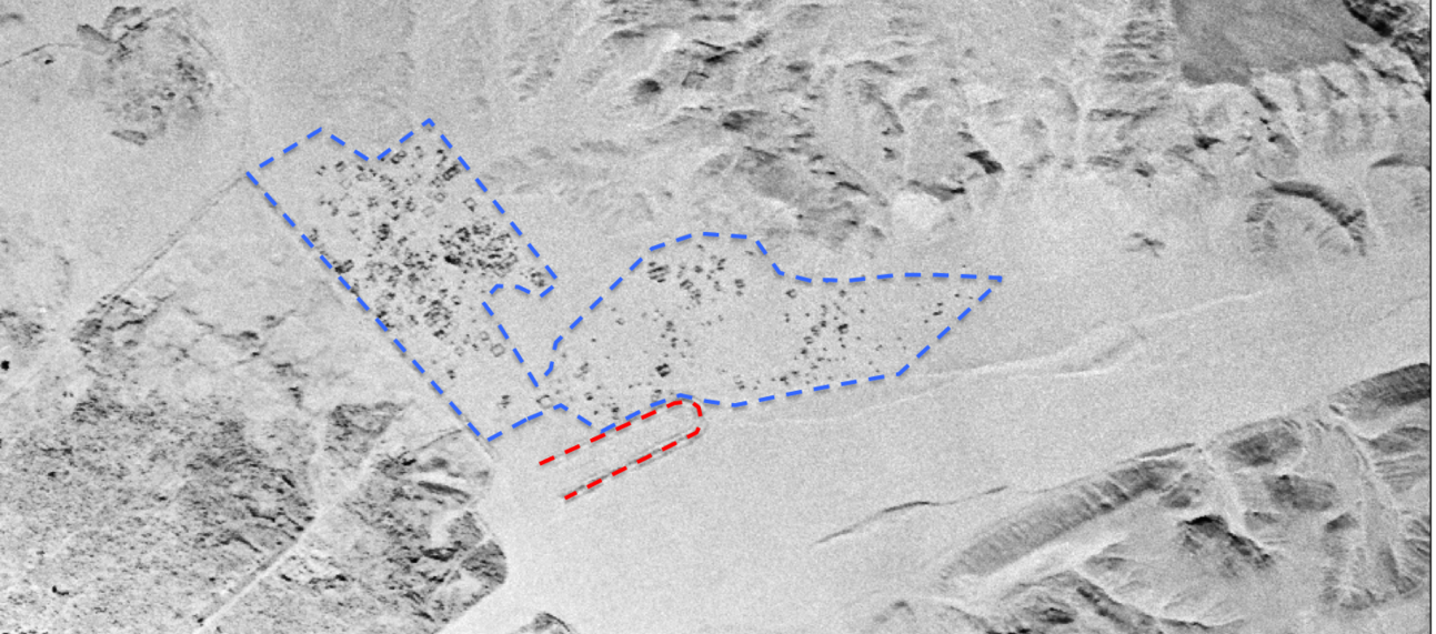
Slideshow 1 (below): These two images shows the increasing development around the circus at Antinoopolis (modern El-Shaikh Ebada) (marked in red) on the east bank of the Nile in Egypt. The first image is a CORONA satellite image from 1968, taken from the CORONA Atlas of the Near East. The second is a DigitalGlobe imagery from March 2013, viewed on Google Earth. The nearby development has increased from a small village to a town (marked in blue) that has expanded up to, and then over one side of the ancient circus.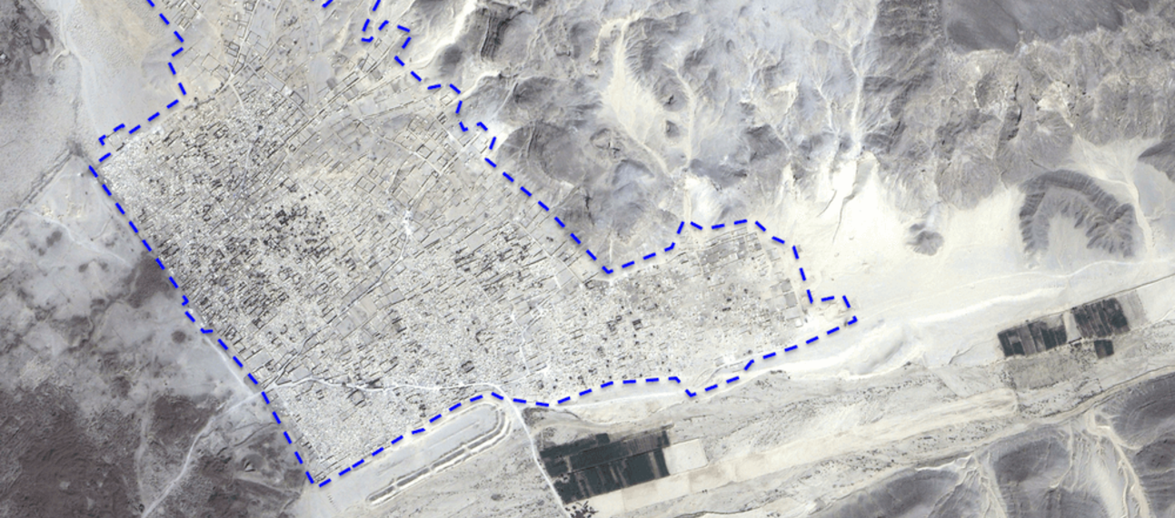
Tell Beydar, Syria (Figure 3, Slideshow 2) is also at risk of expanding development (www.beydar.org).

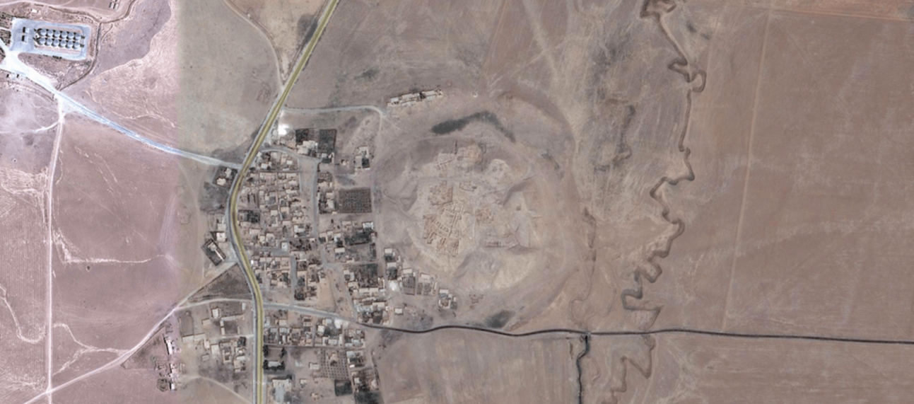
Figure 3: Tell Beydar in an aerial photograph taken by an early pioneer of aerial photography in the Middle East, Antoine Poidebard, in 1934. The site is completely solitary, with the Wadi ‘Awaidj visible in the background.
Slideshow 2 (below): The first image shows Tell Beydar (marked in red) on a CORONA satellite image from the 1960s, courtesy of the CORONA Atlas of the Near East. The image is north aligned: here the wadi is to the east of the site. A small village and some tracks/roads are visible to the west of the site. The most recent image shows the site on DigitalGlobe satellite imagery, courtesy of Google Earth, in 2013. The village has expanded around the site over a buried settlement outside the ancient city walls, together with the accompanying infrastructure, such as tarmac roads. There are buildings on the northern wall, and a football pitch was visible on the southern wall 2010, but this has now been removed. The wadi has dried up and been ploughed away, as has some of the eastern wall.
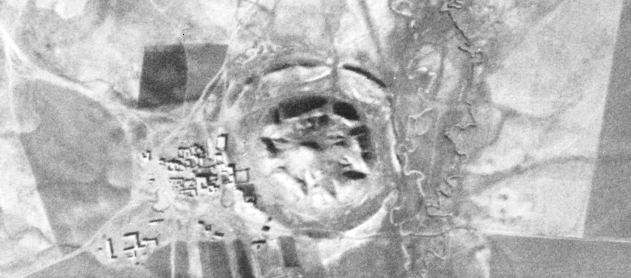
Dam Construction: In order to meet the increasing need for power and water from a rising population, large dams are being constructed. Many sites are destroyed by the extensive construction required to create dams, and many more are inundated. At present, there has only been limited research into the effects on archaeological sites, but waterlogging will affect some remains, as will the weight of the water. Others will be slowly eroded by the lapping water. Here we examine the impact of the west Hasseke dam upon Tell Abu Hufr (Galleries 1 and 2 and Figure 1).


Gallery 1: The satellite images show the site of Tell Abu Hufur on the Wadi Awaidj in Syria. The site was inundated by the building of the west Hasseke Dam in the 1990s, seen on the SPOT image from Google Earth, dated to between 2004–2006 (the site is in the centre of the water; see also Figure 1). However, the area underwent an extensive drought, and the dam waters receded, leaving the site high and dry, as seen on the DigitalGlobe Google Earth image of the dam from September 2013.

Figure 1: Tell Abu Hufur, Syria, July 2010. Copyright: Emma Cunliffe.
Gallery 2 (below): The site can be seen close up on this 1968 CORONA satellite image, from the CORONA Atlas of the Ancient Near East, revealing how it once looked. This can be compared to the appearance of the site on the DigitalGlobe Google Earth image of the dam from September 2013, where the erosion of the site is visible.

