Surveying the Darb Zubaydah in Iraq
Surveying the Darb Zubaydah in Iraq
While studying archaeology as a postgraduate student first at Leicester University through distance learning, and now at Durham University, I have been involved as a volunteer with EAMENA. My main focus while volunteering for EAMENA has been recording the archaeological features and heritage sites in the Iraqi section of the Darb Zubaydah, a site on the UNESCO World Heritage tentative list.
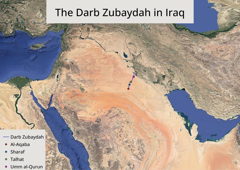
Figure 1. The route of the Darb Zubaydah in Iraq, and the four stations on the UNESCO World Heritage tentative list. Google Earth imagery (Landsat/Copernicus courtesy of Data SIO, NOAA, U.S. Navy, NGA, GEBCO).
The Darb Zubaydah is a hajj pilgrimage route connecting Kufa and Baghdad in modern Iraq with Mecca in modern Saudi Arabia. Although thought to have started as an informal route used by nomadic people groups and traders, it was then officially established as a pilgrimage route by the Abbasid caliphs. The Darb Zubaydah (“Zubaydah’s Road”) is named after Zubaydah bint Jafar, who as wife of the Caliph Harun Al-Rashid funded the building and restoration of much of the road’s infrastructure. This included rest houses, lighthouses and various water storage facilities such as reservoirs, tanks and wells – essential infrastructure for large numbers of pilgrims travelling across the desert. During the Abbasid Caliphate (750-850 CE) Baghdad was the secular capital, leading to the Darb Zubaydah becoming the most important of several hajj pilgrimage routes which linked Islamic cities with Mecca.
The historical significance of the Darb Zubaydah led to its inscription on the UNESCO World Heritage tentative list in January 2022, as a joint listing between Iraq and Saudi Arabia. In Iraq, both the route itself and four stations (Umm al-Qurun, Talhat, Sharaf and Al-Aqaba) have been added to the UNESCO listing. The structural remains of these are clearly visible on satellite imagery, enabling remote recording of the location and condition of the sites. EAMENA’s current project aims to use remote sensing to record and complete a heritage condition assessment for the archaeological features in the Iraqi section of the Darb Zubaydah (figure 1).
Starting with the four stations described by UNESCO, for which coordinates are provided on the UNESCO listing, each archaeological feature within the stations was recorded on a database which included a condition assessment. Features included buildings, water tanks and wells (figure 2).
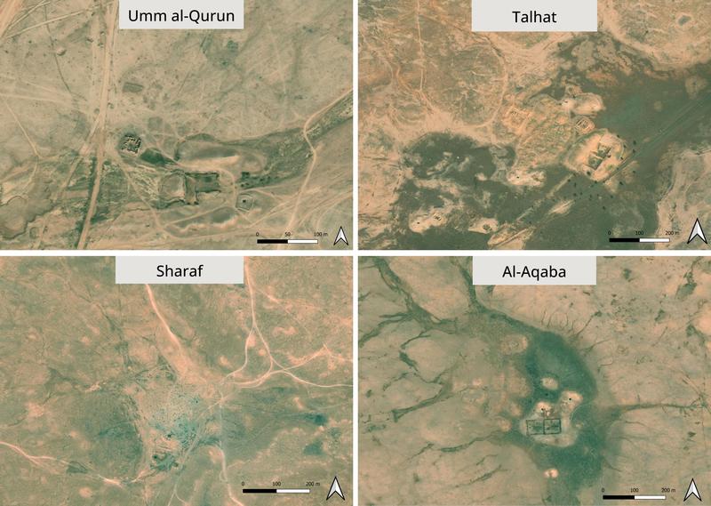
Figure 2. The four Darb Zubaydah stations on the UNESCO World Heritage tentative list. Bing Aerial imagery (©2023 Maxar).
The route of the Darb Zubaydah itself was then traced across the desert (figure 3) and other sites and features along the route were recorded (figure 4). Initially, satellite imagery from Google Earth was used, and this was then compared with Bing Aerial as the varying conditions on the satellite imagery can reveal different archaeological features and how these have changed over time – for instance due to vegetation growth and shifting sand.
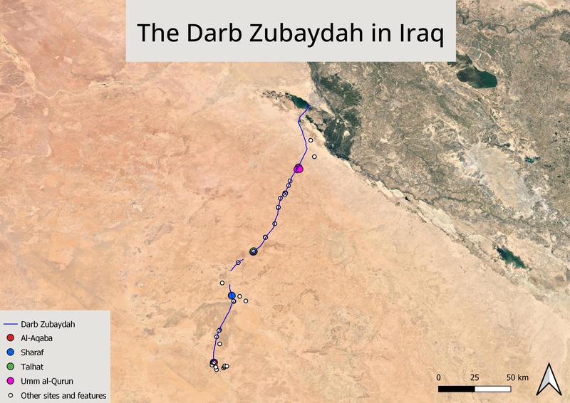
Figure 3. The Darb Zubaydah in Iraq, and stations along the route. Google Earth imagery (Landsat/Copernicus courtesy of Data SIO, NOAA, U.S. Navy, NGA, GEBCO).
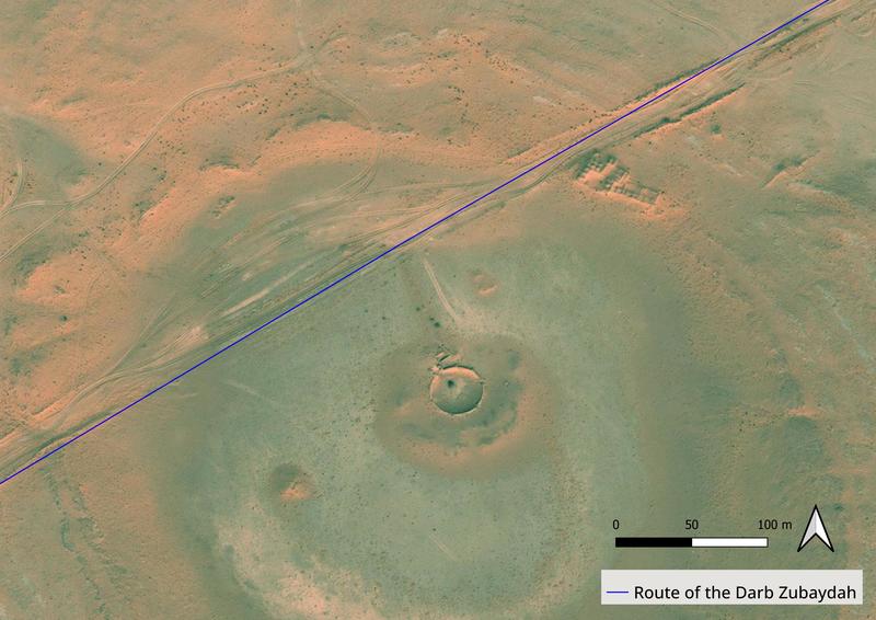
Figure 4. A station on the Darb Zubaydah. Bing Aerial imagery (©2023 Maxar).
A variety of maps from the twentieth century were georeferenced and added as a semi-transparent layer on top of the satellite imagery, enabling several further small sites to be located and names to be attributed to some of the stations already found (figure 5).
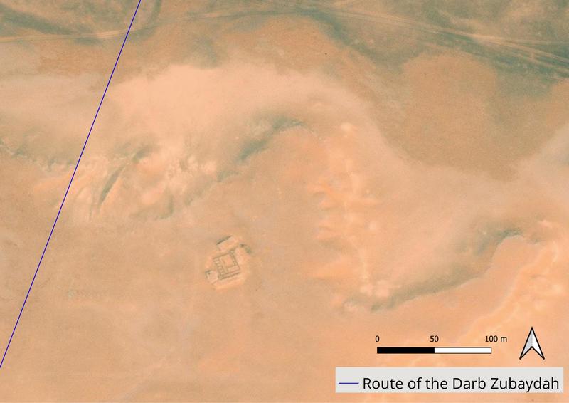
Figure 5. A station on the Darb Zubaydah. Identified from twentieth century maps as likely to be Al ‘Athamin. Bing Aerial imagery (©2023 Maxar).
An archaeological survey undertaken by Al-Rashid (1977) on the Saudi Arabian section of the Darb Zubaydah has also added context to the satellite imagery. Although not covering the Iraq section which EAMENA are recording, Al-Rashid’s survey extended to the site of Al-Aqaba which mean that descriptions of the site as it was in the 1970s can be compared with more recent satellite imagery. Furthermore, Al-Rashid’s measurements of features such as wells, reservoirs, and the distances between them enabled some of the archaeology that he described and photographed to be identified with specific features on the imagery, and it was interesting to add photographic context to the satellite imagery views.
The project is ongoing, and currently I am surveying a wider area around the Darb Zubaydah to find potential sites further away from the road itself. This will hopefully provide wider contextual information about the route and its stations, such as whether archaeological features are limited to locations directly adjacent to the pilgrimage route or spread further afield.
Sources
Al-Rashid, S. A. 1978. ‘Darb Zubaydah In The ʿAbbāsid Period: Historical and Archaeological Aspects’. In Proceedings of the Seminar for Arabian Studies, Vol. 8, pp. 33–45. Available at: http://www.jstor.org/stable/41223199
Al-Rashid, S. A. 1977. A critical study of the pilgrim road between Kufa and Mecca (darb zubaydah) with the aid of fieldwork. PhD thesis, University of Leeds. Available at: https://etheses.whiterose.ac.uk/21108/
Fareeq E. W. 2021. ‘Overland Hajj Route Darb Zubayda’. Muslim Heritage. Available at: https://muslimheritage.com/darb-zubayda/
UNESCO. 2022. The Hajj Pilgrimage Routes: The Darb Zubaydah (Iraq). Available at: https://whc.unesco.org/en/tentativelists/6576/


