Visiting sites on the ground in Jordan, Part 1: Amra pendant 1
In the EAMENA Project, most of the time we see the world from above, through satellite imagery or aerial photographs. These are very informative and, moreover, a quick way to examine and assess large areas of the landscape. However, there are some things that we simply cannot see from above. For example, using only remote sensing in most cases we cannot tell the date of a site, nor can we see smaller details or the inside of buildings. We can sometimes gain additional information from published reports, but when these are not available, there is no substitute for a visit to the site on the ground. Of course, this is not possible for all sites, but using information gathered from satellite imagery, we can identify areas that are of specific interest for their potential heritage value or because they are particularly threatened. We can also decide to visit a sample of sites identified through satellite imagery or aerial photography, to check if what we think we see on the imagery is actually there in reality. In May 2017, I did exactly that. Together with other EAMENA team members, we identified a number of sites that would be worth visiting in Jordan. In a series of blogs I will report my findings, starting with a site called ‘Amra pendant 1’, which was originally identified by the Aerial Archaeology in Jordan (AAJ) team (see APAAME).
On a hot and windy day I set out, kindly accompanied by CBRL’s Bill Finlayson, to visit the ‘Amra pendant 1’ site near Azraq in the steppe east of Amman. This pendant was identified as an archaeological site when the APAAME team flew over it and photographed it in the 1990s.
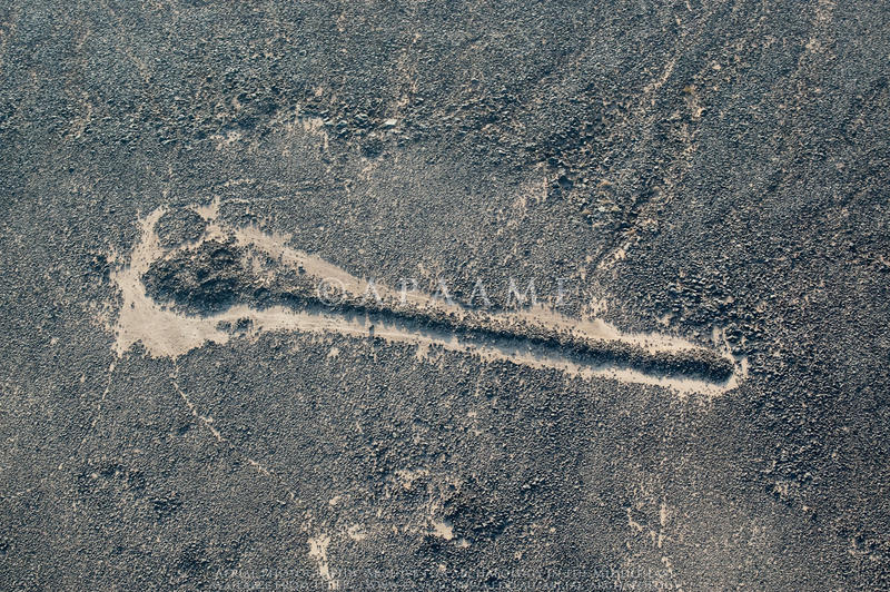
Figure 1. Amra pendant 1 photographed from the air by the APAAME team in 2009 (APAAME_20090917_NQ-0038).
Pendants are so-named because of their shape: their ‘tail’ consists of a line of cairns (burial mounds) with a ‘head’ formed of a larger cairn or a structure like a tower tomb. They can be found all over the Middle East and are especially prevalent in the deserts of Jordan and the Arabian Peninsula (see example searches in the EAMENA database).

Figure 2. Distribution of pendants currently in the EAMENA database. This is still work in progress, there are many more pendants present in the Middle East.
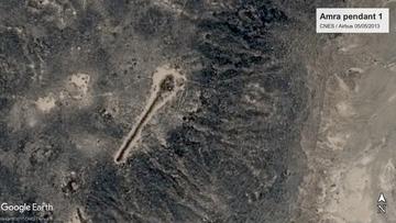
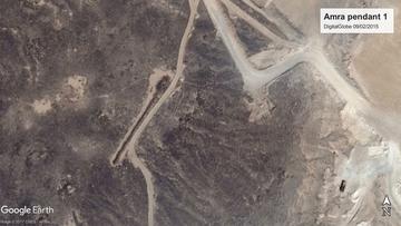
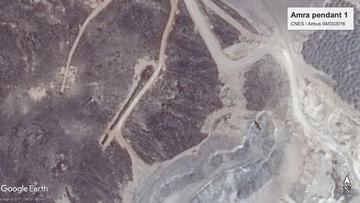
When monitoring this pendant over the years, the AAJ team found that it was increasingly under threat of development, something that is also clear from Google Earth satellite imagery. A large quarry now exists just east of the pendant, the new Azraq bypass is being built just north of it, and bulldozing is going on in the desert around it, just next to the pendant, and even straight through it (as well as through other nearby archaeological features).
|
|
|
Figures 3a-c. The pendant in a) 2013 (CNES / Airbus, 05/05/2013), b) 2015 (DigitalGlobe, 09/02/2015), and c) 2016 (CNES / Airbus, 04/03/2016). A bulldozer track had appeared next to the pendant in 2015, and a bulldozer had cut through the pendant by 2016 (CNES / Airbus and DigitalGlobe via GoogleEarth).
The assessment based on the satellite and aerial imagery was confirmed on the ground, although the scale of it all is even more impressive. Driving there over the wide, empty (because yet unfinished) by-pass road, evidence of bulldozing in the desert is present everywhere. Nevertheless, the pendant itself is in relative good shape so far. Unfortunately, however, since the last APAAME visit in May 2016, the bulldozer has cut through the pendant again. As visible on the imagery since 2015, there is a bulldozed track next to the pendant. On the other side, the area emptied during the pendant construction appears to be occasionally used as a track, based on car wheel marks. What was not visible on the imagery is that some digging has been going on in the pendant, possibly looting.
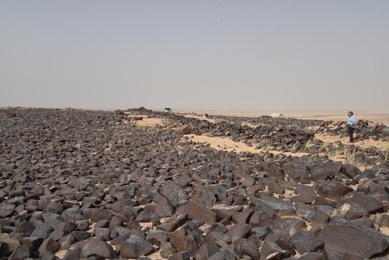
Figure 4. The pendant seen from the west with the tail in the foreground and the head to the horizon (photo P. Flohr).
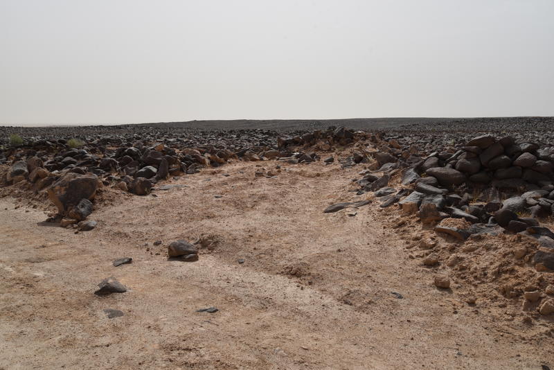
Figure 5. New bulldozer cut through the pendant, observed in May 2017 (photo P. Flohr).
A ground visit also provides more detailed information on the features than can be seen from the air. ‘Amra pendant 1’ consists of a ‘head’ with what appear to be walls of a structure, possibly a tower tomb, possibly not unlike the one recently excavated by the Jebel Qurma project. Its ‘tail’ consists of 29 to 31 cairns (the exact number is not completely clear due to some collapse). There would originally have been more if not for the two bulldozer cuts. The still-preserved cairns have collapsed in places, but are largely intact. What is also interesting is that the area around the pendant is full of more archaeology, with a cairn field to its southeast. The nearest cairn has a large hole in it where it appears looters have been at work.
The pendant and its surroundings are under serious threat of more bulldozing as work in the adjacent mine and road construction continue. The mine might stop at the edge of the basalt, where the pendant is present, and the road does not directly cross the pendant (although other remains might well be present in its track). The extensive bulldozing associated with both are likely to damage the archaeological remains further and might even destroy them. Looting of the cairn field and the pendant can also be expected to continue, unless there can be more careful monitoring of the area. The new information about this site has already been put in the EAMENA database, which will be shared with the Department of Antiquities in Jordan to hopefully aid in the protection of this and other sites.


