EAMENA, UNESCO, and Yemeni authorities collaborate to build a national digital database to monitor Yemen’s rich heritage landscapes
Posted 31.7.2018
Andrea Zerbini, Bijan Rouhani and Michael Fradley write
Following a successful grant increase bid earlier this month to the British Council’s Cultural Protection Fund (CPF), the Endangered Archaeology of the Middle East and North Africa (EAMENA) project will now embark on the construction of a digital heritage management platform to help support the vital work of Yemen’s national authorities.
As part of its remote sensing reconnaissance of threatened archaeological sites in the MENA region, the EAMENA Project has so far identified over 50,000 archaeological sites in Yemen, many of which had not been previously scientifically recorded.

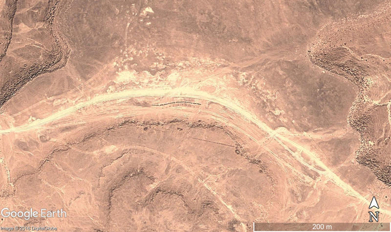
Figure 1: Prehistoric monuments, including pendant and trilith features, threatened by the impact of dirt-road tracks that have developed alongside. Satellite image: DigitalGlobe. Map data: Google Earth.
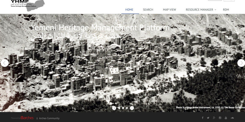
Building on international commitments made at UNESCO-organised meetings in Sharjah and Venice in 2016 and in Amman in July 2017, a plan was formed to integrate all of the known archaeological datasets from Yemen into a single, digital platform. The EAMENA team was charged with the development of the new database, drawing on the recommendations and requirements of Yemen’s General Organisation for Antiquities and Museums (GOAM). The new system, known as the Yemen Heritage Management Platform (YHMP) is modelled on the existing EAMENA database platform (funded by Arcadia) and adopts the open-source Arches inventory package developed by the Getty Conservation Institute and the World Monuments Fund. The YHMP is a dynamic repository for recording and monitoring the condition of heritage sites and landscapes across Yemen, allowing GOAM staff to draw out relevant information instantaneously in response to identified heritage threats. The YHMP will fundamentally improve heritage management mechanisms in Yemen, allowing for a more efficient deployment of resources.

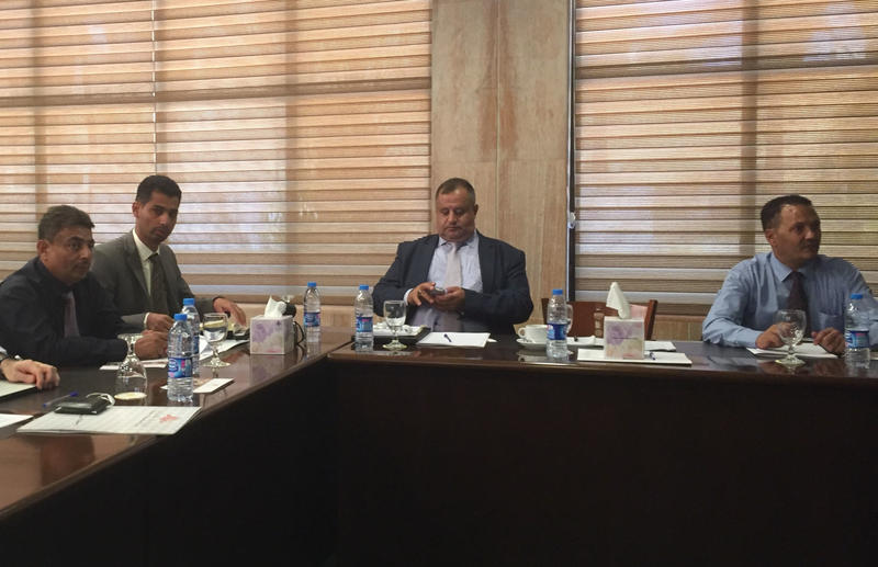
Figure 2: Members of the GOAM team, including their director Muhannad al-Siyyânî, attend the YHMP focus group workshop in Amman in the summer of 2017
To build on this technical development, this new CPF grant will fund a detailed training workshop for GOAM staff on how to use the YHMP. Due to the on-going conflict in Yemen, the session will be held in Amman, Jordan, in the same location used for previous meetings and our CPF training workshops for our Palestinian and Jordanian colleagues. Key GOAM staff from across the country will attend this workshop, to develop their own skills and reach a level that will allow them to pass on training to colleagues back in Yemen. In addition to providing I.T. infrastructure and detailed training in the use of YHMP, the workshop will also see the transfer of skills in the use of satellite imagery to identify, document and monitor heritage sites, a key component of the EAMENA methodology.

Figure 3: The landing page of the Yemen Heritage Management Platform
Finally, the CPF grant will help support the transfer of existing archaeological datasets in to the new YHMP system. This will include information collected by the numerous international research teams who have worked in Yemen over recent decades. Under the overall guidance of UNESCO, in response to the threats to cultural heritage posed by the current conflict this international collaboration will ensure that data from as many sources as possible will be used to support the work of Yemen’s GOAM.

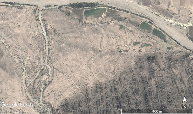
Figure 4: A possible large fortified site threatened by encroachment of modern agricultural fields. Satellite image: DigitalGlobe. Map data: Google Earth.
تعاون مشروع ايمينا، اليونسكو والحكومة اليمنية لبناء قاعدة بيانات وطنية للتراث والاثار اليمني
كتب أندريا زربيني، بيجان روحاني، ومايكل فرايدلي
نجح مشروع ايمينا (الاثار المهددة في الشرق الأوسط وشمال أفريقيا) في الحصول على تمويل إضافي من صندوق حماية التراث التابع للمجلس البريطاني من أجل تأسيس قاعدة بيانات وطنية خاصة باليمن لإدارة التراث والحفاظ عليه بالتعاون مع المؤسسات اليمنية المختلفة.
قام مشروع ايمينا بتحديد ٥٠.٠٠٠ موقع أثري لم يتم تحديدهم من قبل كجزء من مشروع ايمينا لترقب التهديدات في المنطقة من الناحية الاثرية.
بعد العديد من اللقاءات الناجحة لاجتماعات اليونسكو في الشارقة ومدينة البندقية عام ٢٠١٦، وفي عمان عام ٢٠١٧، تم الاتفاق على تجميع كل قواعد البيانات والمعلومات الاثرية المختلفة لليمن في قاعدة بيانات واحدة جديدة. وتم تكليف مشروع ايمينا بإنشاء قاعدة بيانات متخصصة، وفقا لمتطلبات الهيئة العامة للآثار والمتاحف اليمنية. يتميز النظام الجديد لقاعدة البيانات والمسمى (قاعدة بيانات التراث اليمني) بأنه مشتق من قاعدة البيانات الأساسية لمشروع ايمينا٠الممول من اركاديا والمبني على نظام اركيس (الاقواس) المطور من خلال مؤسسة جيتي للترميم ومؤسسة المباني الاِثرية.
ان قاعدة بيانات التراث اليمني عامل حيوي لتوثيق ومتابعة حالة المواقع التراثية في اليمن، والتي تتيح لموظفي ومفتشي إدارة الاثار والمتاحف اليمنية تحديد المواقع الأكثر احتياجا للاهتمام بها. ان قاعدة بيانات اليمن سوف تساعد على إدارة التراث والحفاظ عليه.
ان التمويل الجديد من صندوق حماية التراث الثقافي سوف يقدم فرص عديدة لتدريب موظفي ومفتشي الهيئة العامة للآثار والمتاحف اليمنية لاستخدام وتشغيل قاعدة البيانات الجديدة. ونظرا للصراع القائم في اليمن، فسوف تقام أنشطة التدريب المختلفة في عمان، الأردن في نفس مكان التدريب الذي تم تقديمه للزملاء الأردنيين والفلسطينيين. سوف يحضر مسؤولين مختلفين من اليمن أنشطة التدريب لتنمية مهاراتهم والوصول للمستوى المطلوب لتدريب أخرين في اليمن. ان التدريب وورش العمل المنتظرة سوف تتيح تزويد الزملاء في اليمن بالخبرة اللازمة لاستخدام الصور الجوية لتحديد ومراقبة المواقع التراثية، وهو أحد العوامل الأساسية في مشروع ايمينا.
يساعد التمويل الجديد على نقل قواعد البيانات الاثرية الموجودة حاليا لقاعدة البيانات الجديدة. وسوف تضم قاعدة البيانات المعلومات الجديدة والقديمة التي جمعتها البعثات العاملة هناك وتحت رعاية اليونسكو، وللحاجة الملحة للعمل في اليمن في ظل الأوضاع القائمة، سيتيح التعاون الدولي في مجال الاثار من مختلف الجهات المساعدة للهيئة العامة للآثار والمتاحف اليمنية.


